
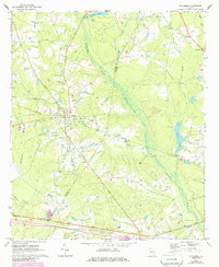
1971 Map of Stillmore
USGS Topo · Published 1973About this map
Stillmore serves as the central hub of this Georgia landscape, situated near the Emanuel Co Candler Co line in the early 1970s. The town's layout is shaped by the presence of an Old Railroad Grade, reflecting the importance of historical transit corridors even as their primary industrial roles shifted. This survey offers significant genealogical value through its careful mapping of local burial grounds, including Oak Grove Cem, Stillmore Cem, Warren Cem, and the St Matthew Cem to the southeast. Waterways like the Canoochee River and Reedy Creek define the low-lying drainage patterns, punctuated by landmarks such as a Grist Mill near Durden Pond and a Gaging Station on the eastern edge. The map also captures local extraction sites, noting several Gravel Pits distributed across the terrain.
Find a feature on this map
22 named features on this map. Tap any name to fly to it.
Don’t see what you’re looking for? This feature index may not catch every label — zoom into the map to look around manually.
Map Details
Editions of this 1971 Stillmore Map
2 editions found
Other maps of this area

1957 · Macon
USGS Topo · 1:250,000

1958 · Macon
USGS Topo · 1:250,000

1964 · Macon
USGS Topo · 1:250,000

1970 · Cobbtown
USGS Topo · 1:24,000
1970 · Metter
USGS Topo · 1:24,000
1970 · Metter SE
USGS Topo · 1:24,000

1970 · Nunez
USGS Topo · 1:24,000

1970 · Oak Park
USGS Topo · 1:24,000

1971 · Swainsboro
USGS Topo · 1:24,000

1971 · Twin City
USGS Topo · 1:24,000