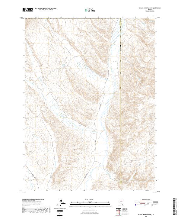
2021 Map of Swales Mountain NW
USGS Topo · Published 2021About this map
Maggie Creek Rd follows the winding path of Maggie Cr through this high-altitude basin on the boundary of Eureka and Elko counties. The drainage network is dense with seasonal and perennial flows, including Fish Cr, Jack Cr, and Little Jack Cr, which carve through the terrain of Townships 35 and 36 North. Small water sources like Chicken Springs and Coyote Cr dot the landscape, suggesting the historical importance of reliable water for ranching or travel in this arid environment. The map shows a region defined by its hydrology and administrative lines, where the convergence of Cottonwood Cr and other tributaries into the main Maggie Creek valley creates a distinct natural corridor through the northern Nevada desert.
Find a feature on this map
18 named features on this map. Tap any name to fly to it.
Don’t see what you’re looking for? This feature index may not catch every label — zoom into the map to look around manually.
Map Details
Editions of this 2021 Swales Mountain NW Map
This is the sole edition of this map. No revisions or reprints were ever made.
Other maps of this area

1955 · McDermitt
USGS Topo · 1:250,000

1955 · Winnemucca
USGS Topo · 1:250,000

1958 · Winnemucca
USGS Topo · 1:250,000

1958 · Blue Basin
USGS Topo · 1:24,000

1958 · Huntsman Ranch
USGS Topo · 1:24,000
1958 · Swales Mountain
USGS Topo · 1:24,000

1959 · McDermitt
USGS Topo · 1:250,000

1962 · Winnemucca
USGS Topo · 1:250,000

1968 · Rodeo Creek NE
USGS Topo · 1:24,000

1968 · Welches Canyon
USGS Topo · 1:24,000