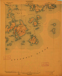
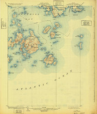
1904 Map of Swan Island
USGS Topo · Published 1912About this map
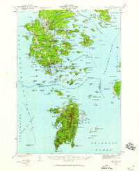
Steamboat routes crisscross Blue Hill Bay and the Atlantic Ocean in this early twentieth-century coastal study, illustrating the maritime dependence of Hancock County's outer islands. The village of Swan Island serves as a central hub, with the nearby settlements of Minturn and Atlantic supporting the local fishing and seafaring economy. The intricate shoreline is defined by deep natural harbors such as Burntcoat Harbor and Lunts Harbor on Long Island, where the settlement of Frenchboro remains a remote outpost. To the north, the tip of Mount Desert Island includes the established communities of Tremont, Mc Kinley, and Southwest Harbor. Navigational landmarks like Bass Harbor Head and the hazardous Channel Rock are clearly charted, alongside numerous smaller landmasses like Placentia I. and the Cranberry Isles, providing a detailed look at the granite-edged geography before modern bridge connections and tourism transformed the region's character.
Find a feature on this map
109 named features on this map. Tap any name to fly to it.
Don’t see what you’re looking for? This feature index may not catch every label — zoom into the map to look around manually.
Map Details
Editions of this 1904 Swan Island Map
4 editions found

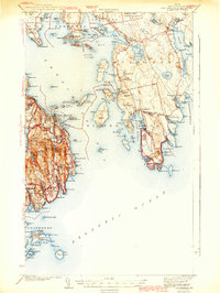
Other maps of this area

1904 · Deer Isle
USGS Topo · 1:62,500

1904 · Mount Desert
USGS Topo · 1:62,500

1904 · Swan Island
USGS Topo · 1:62,500

1904 · Bar Harbor
USGS Topo · 1:62,500

1904 · Bluehill
USGS Topo · 1:62,500

1905 · Penobscot Bay
USGS Topo · 1:125,000
1942 · Bar Harbor
USGS Topo · 1:62,500
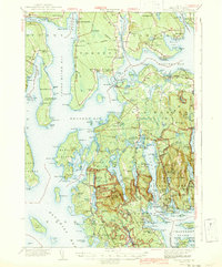
1942 · Mount Desert
USGS Topo · 1:62,500
1942 · Deer Isle
USGS Topo · 1:62,500
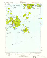
1943 · Swans Island
USGS Topo · 1:62,500