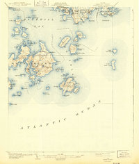
1904 Map of Swan Island
USGS Topo · Published 1943About this map
The granite shores and seafaring outposts of Hancock County are captured here as they appeared at the turn of the century. Centered on the intricate coastline of Swan Island, this survey highlights the maritime importance of Burntcoat Harbor and the clustered settlements of Minturn and Atlantic. The map details a complex archipelago where life was dictated by the tides of Blue Hill Bay and the Atlantic Ocean, showing isolated communities like Frenchboro on Long Island and the neighboring Placentia Island. Navigational aids, including the Blue Hill Bay L.H., mark the passages used by local fishermen and coastal traders. Beyond the larger islands, a scatter of smaller landmasses like Marshall Island, Opechee I., and Great Duck Island illustrate the rugged geography of the Maine coast before modern development altered these remote working waterfronts.
Find a feature on this map
102 named features on this map. Tap any name to fly to it.
Don’t see what you’re looking for? This feature index may not catch every label — zoom into the map to look around manually.
Map Details
Editions of this 1904 Swan Island Map
4 editions found
Other maps of this area

1904 · Deer Isle
USGS Topo · 1:62,500

1904 · Mount Desert
USGS Topo · 1:62,500

1904 · Swan Island
USGS Topo · 1:62,500

1904 · Bar Harbor
USGS Topo · 1:62,500

1904 · Bluehill
USGS Topo · 1:62,500

1905 · Penobscot Bay
USGS Topo · 1:125,000

1942 · Bar Harbor
USGS Topo · 1:62,500

1942 · Mount Desert
USGS Topo · 1:62,500

1942 · Deer Isle
USGS Topo · 1:62,500

1943 · Swans Island
USGS Topo · 1:62,500