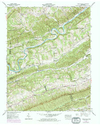
1941 Map of Swan Island
USGS Topo · Published 1973About this map
The Clinch River meanders through the heart of this East Tennessee landscape, defining the boundaries between Claiborne, Hancock, and Grainger counties as it was mapped in 1941. The river serves as the primary corridor for commerce and community, evidenced by the presence of Manning Ferry and Lawson Mill near the distinctive Lawson Bend. This survey documents a deeply rural settlement pattern of the early 1940s, where small community centers like Bray are anchored by institutions such as Big Creek Chapel and Lawson Sch.
Find a feature on this map
69 named features on this map. Tap any name to fly to it.
Don’t see what you’re looking for? This feature index may not catch every label — zoom into the map to look around manually.
Map Details
Editions of this 1941 Swan Island Map
2 editions found
Other maps of this area

1883 · Morristown
USGS Topo · 1:125,000

1887 · Jonesville
USGS Topo · 1:125,000

1891 · Jonesville
USGS Topo · 1:125,000

1893 · Morristown
USGS Topo · 1:125,000

1895 · Morristown
USGS Topo · 1:125,000

1932 · Hagan
USGS Topo · 1:62,500

1935 · Rogersville
USGS Topo · 1:48,000

1935 · Tate Springs
USGS Topo · 1:48,000

1935 · Lee Valley
USGS Topo · 1:24,000
1935 · Colman
USGS Topo · 1:24,000