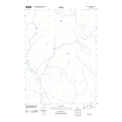
2010 Map of Swan Lake
USGS Topo · Published 2010About this map
Swan Lake sits at the heart of this landscape where the water of Swan Lake Slough and Swan Lake Creek meets the rugged eastern slopes of the Malad Range. The settlement pattern here is sparse, centered on the small communities of Swan Lake and Coulam, connected by a network of rural routes like Coulam Rd and Oxford Rd. The terrain is defined by significant elevations such as Dry Hollow Mountain and Heart Mountain, which overlook the natural springs and drainages that sustain this high-desert environment.
Find a feature on this map
29 named features on this map. Tap any name to fly to it.
Don’t see what you’re looking for? This feature index may not catch every label — zoom into the map to look around manually.
Map Details
Editions of this 2010 Swan Lake Map
This is the sole edition of this map. No revisions or reprints were ever made.
Other maps of this area

1915 · Preston
USGS Topo · 1:96,000

1918 · Preston
USGS Topo · 1:125,000

1954 · Pocatello
USGS Topo · 1:250,000

1955 · Preston
USGS Topo · 1:250,000

1958 · Pocatello
USGS Topo · 1:250,000

1958 · Preston
USGS Topo · 1:250,000

1962 · Preston
USGS Topo · 1:250,000

1968 · Oxford
USGS Topo · 1:24,000

1968 · Clifton
USGS Topo · 1:24,000
1968 · Downey East
USGS Topo · 1:24,000