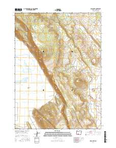
2017 Map of Swan Lake
USGS Topo · Published 2017About this map
Swan Lake Rim dominates the central landscape of this Klamath County region, creating a dramatic topographical divide between the expansive Swan Lake Valley and the upland plateaus to the east. The 2017 survey illustrates a complex hydrologic network defined by numerous named water sources, including Jack Frost Spring, Big Springs, and Egert Spring, which feed into local drainages like Buck Cr and Rattlesnake Cr.
Find a feature on this map
36 named features on this map. Tap any name to fly to it.
Don’t see what you’re looking for? This feature index may not catch every label — zoom into the map to look around manually.
Map Details
Editions of this 2017 Swan Lake Map
This is the sole edition of this map. No revisions or reprints were ever made.
Other maps of this area

1889 · Klamath
USGS Topo · 1:250,000

1894 · Klamath
USGS Topo · 1:250,000

1955 · Klamath Falls
USGS Topo · 1:250,000

1957 · Merrill
USGS Topo · 1:62,500

1957 · Swan Lake
USGS Topo · 1:62,500

1957 · Malin
USGS Topo · 1:62,500

1958 · Klamath Falls
USGS Topo · 1:250,000

1960 · Beatty
USGS Topo · 1:62,500

1975 · Merrill NW
USGS Topo · 1:24,000
1985 · Dairy
USGS Topo · 1:24,000