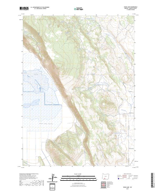
2023 Map of Swan Lake
USGS Topo · Published 2023About this map
Swan Lake Rim dominates the central topography of this Klamath County landscape, creating a sharp vertical divide between the low-lying wetlands and the high volcanic plateau to the east. Below the rim, the expansive Swan Lake Valley is characterized by its namesake Swan Lake, a significant water body surrounded by seasonal marshlands. This hydraulic system is supported by a network of drainage features including Buck Creek and Rattlesnake Creek, which cut through the elevated terrain before reaching the valley floors.
Find a feature on this map
36 named features on this map. Tap any name to fly to it.
Don’t see what you’re looking for? This feature index may not catch every label — zoom into the map to look around manually.
Map Details
Editions of this 2023 Swan Lake Map
This is the sole edition of this map. No revisions or reprints were ever made.
Other maps of this area

1889 · Klamath
USGS Topo · 1:250,000

1894 · Klamath
USGS Topo · 1:250,000

1955 · Klamath Falls
USGS Topo · 1:250,000

1957 · Merrill
USGS Topo · 1:62,500

1957 · Swan Lake
USGS Topo · 1:62,500

1957 · Malin
USGS Topo · 1:62,500

1958 · Klamath Falls
USGS Topo · 1:250,000

1960 · Beatty
USGS Topo · 1:62,500

1975 · Merrill NW
USGS Topo · 1:24,000
1985 · Dairy
USGS Topo · 1:24,000