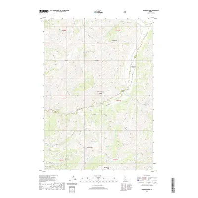
2020 Map of Swanholm Peak
USGS Topo · Published 2020About this map
Boise National Forest encompasses this high-elevation Idaho backcountry where the North Fork Boise River and N Fork Boise River converge. The landscape is defined by a dense network of mountain peaks and watercourses, anchored by the prominent Swanholm Peak and Swanholm Lookout. In the eastern portion of the quadrangle, the Graham USFS Airport serves as a remote aviation point near Graham Cr and Graham Peak.
Find a feature on this map
46 named features on this map. Tap any name to fly to it.
Don’t see what you’re looking for? This feature index may not catch every label — zoom into the map to look around manually.
Map Details
Editions of this 2020 Swanholm Peak Map
This is the sole edition of this map. No revisions or reprints were ever made.
Other maps of this area

1891 · Bear Valley
USGS Topo · 1:125,000

1893 · Bear Valley
USGS Topo · 1:125,000

1894 · Rocky Bar
USGS Topo · 1:125,000

1955 · Hailey
USGS Topo · 1:250,000

1957 · Challis
USGS Topo · 1:250,000

1959 · Hailey
USGS Topo · 1:250,000

1960 · Challis
USGS Topo · 1:250,000

1962 · Hailey
USGS Topo · 1:250,000

1963 · Challis
USGS Topo · 1:250,000
1972 · Bear River
USGS Topo · 1:24,000