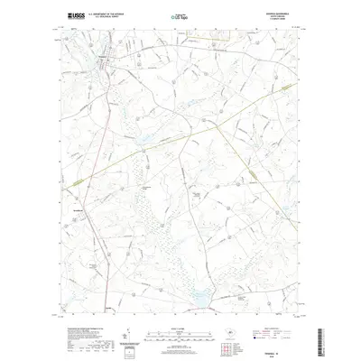
2020 Map of Swansea
USGS Topo · Published 2020About this map
The town of Swansea sits at the northern edge of this Midlands landscape, where the local economy and geography are defined by a complex network of wetlands and creek branches. A series of historic millponds, including Etheredge Millpond, Layseth Millpond, and Shannon Pond, illustrate the long-standing management of water resources in the region. The southern portion of the quadrangle includes the small settlement of Woodford and the significant drainage of Bull Swamp Cr, which is fed by numerous tributaries such as Third Cr, Fourth Cr, and Cow Br. This modern mapping provides a clear view of the area's rural character, showing the distribution of family-named landmarks and historical church sites. Genealogists may find value in the locations of the Trinity United Methodist Church Cem and Canaan United Methodist Church Cem, which serve as anchors for the local community amidst the surrounding timberlands and agricultural fields.
Find a feature on this map
117 named features on this map. Tap any name to fly to it.
Don’t see what you’re looking for? This feature index may not catch every label — zoom into the map to look around manually.
Map Details
Editions of this 2020 Swansea Map
This is the sole edition of this map. No revisions or reprints were ever made.
Other maps of this area

1944 · Edmund
USGS Topo · 1:62,500

1946 · Woodford
USGS Topo · 1:62,500

1946 · St. Matthews
USGS Topo · 1:62,500

1948 · Hopkins
USGS Topo · 1:62,500

1953 · Saylors Lake
USGS Topo · 1:24,000

1954 · Augusta
USGS Topo · 1:250,000

1957 · Augusta
USGS Topo · 1:250,000

1958 · Augusta
USGS Topo · 1:250,000

1961 · Augusta
USGS Topo · 1:250,000

1962 · Augusta
USGS Topo · 1:250,000