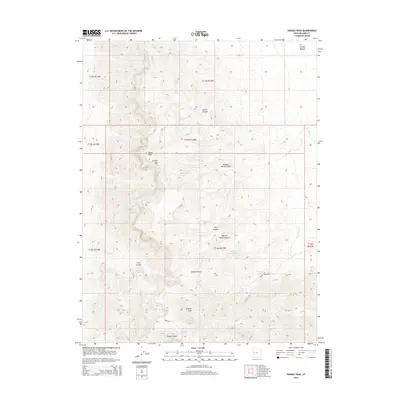
2014 Map of Swasey Peak
USGS Topo · Published 2014About this map
Swasey Peak and the high elevations of Swasey Mtn dominate this 2014 survey of the House Range in Millard County. The map provides a detailed view of the water sources essential for life and movement in this arid landscape, from Antelope Spring and Swasey Spring to more secluded points like Robbers Roost Spring and Chokecherry Spring. These springs are often the destination or origin for the area's primitive routes, including Sinbad Rd and Swasey Spring Rd. The complex topography is defined by significant drainage systems such as Box Canyon and Sawmill Basin Canyon, while features like Tatow Knob serve as prominent landmarks for navigation across the high desert terrain. The distribution of names suggests a history of livestock grazing and perhaps hiding spots, evidenced by the descriptive naming of Robbers Roost Canyon.
Find a feature on this map
28 named features on this map. Tap any name to fly to it.
Don’t see what you’re looking for? This feature index may not catch every label — zoom into the map to look around manually.
Map Details
Editions of this 2014 Swasey Peak Map
This is the sole edition of this map. No revisions or reprints were ever made.
Other maps of this area

1908 · Fish Springs
USGS Topo · 1:250,000

1910 · Fish Springs
USGS Topo · 1:250,000

1953 · Topaz Mtn
USGS Topo · 1:62,500

1953 · Delta
USGS Topo · 1:250,000

1958 · Delta
USGS Topo · 1:250,000

1962 · Delta
USGS Topo · 1:250,000

1967 · Sand Pass
USGS Topo · 1:24,000

1967 · Sand Pass SE
USGS Topo · 1:24,000

1972 · Whirlwind Valley SW
USGS Topo · 1:24,000

1972 · Swasey Peak SW
USGS Topo · 1:24,000