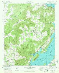
1947 Map of Swearengin
USGS Topo · Published 1972About this map
Guntersville Lake and the high tablelands of Gunters Mountain dominate this landscape on the Jackson and Marshall County line. The map captures a transition in the Tennessee Valley, where deep coves and hollows like Stillhouse Hollow and Woodall Hollow cut into the plateau. The settlement of Swearengin sits centrally among several community landmarks, including Oak Grove Church and the New Prospect School. To the north, the subterranean topography is notable, featuring Cathedral Caverns, Blowing Cave, and Saltpeter Cave. The shoreline of the Guntersville Reservation shows a developing recreational and utility landscape, with a Gaging Station and the Preston Cabin Site Area established along the water. Numerous small family or community cemeteries such as Zions Rest Cem and Maple Cem are scattered across the coves, providing a detailed record of the area's rural social geography.
Find a feature on this map
77 named features on this map. Tap any name to fly to it.
Don’t see what you’re looking for? This feature index may not catch every label — zoom into the map to look around manually.
Map Details
Editions of this 1947 Swearengin Map
2 editions found
Other maps of this area

1885 · Gadsden
USGS Topo · 1:125,000

1888 · Gadsden
USGS Topo · 1:125,000

1888 · Scottsboro
USGS Topo · 1:125,000

1892 · Scottsboro
USGS Topo · 1:125,000

1892 · Gadsden
USGS Topo · 1:125,000

1895 · Gadsden
USGS Topo · 1:125,000

1903 · Gadsden
USGS Topo · 1:125,000

1936 · Scottsboro
USGS Topo · 1:24,000

1936 · Columbus City
USGS Topo · 1:24,000

1936 · Langston
USGS Topo · 1:24,000