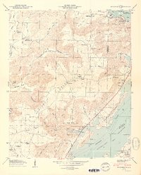
1950 Map of Swearengin
USGS Topo · Published 1950About this map
Gunters Mountain dominates this mid-century landscape in Northeast Alabama, rising sharply above the complex shoreline of the Guntersville Reservoir. The settlement of Swearengin sits atop the mountain ridge, surrounded by a high concentration of community landmarks including the New Prospect School, Oak Grove Church, and Prospect Church. The rugged topography is defined by deep coves and hollows named for early families, such as Chambless Hollow, Woodall Hollow, and John Law Hollow. Near the river, the map identifies specific recreational and historical footprints like the Preston Cabin Site Area and the South Sauty Point Cabin Site Area. Geologic features like Blowing Cave and Saltpeter Cave dot the slopes of Pine Mtn, while numerous cemeteries including Zions Rest Cem and McFarlane Cem provide essential data for tracing family roots in this rural Jackson and Marshall County borderland.
Find a feature on this map
74 named features on this map. Tap any name to fly to it.
Don’t see what you’re looking for? This feature index may not catch every label — zoom into the map to look around manually.
Map Details
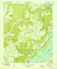
Editions of this 1950 Swearengin Map
2 editions found
Other maps of this area

1885 · Gadsden
USGS Topo · 1:125,000

1888 · Gadsden
USGS Topo · 1:125,000

1888 · Scottsboro
USGS Topo · 1:125,000

1892 · Scottsboro
USGS Topo · 1:125,000

1892 · Gadsden
USGS Topo · 1:125,000

1895 · Gadsden
USGS Topo · 1:125,000

1903 · Gadsden
USGS Topo · 1:125,000

1936 · Scottsboro
USGS Topo · 1:24,000

1936 · Columbus City
USGS Topo · 1:24,000

1936 · Langston
USGS Topo · 1:24,000