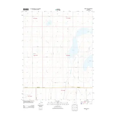
2013 Map of Swede Lake
USGS Topo · Published 2013About this map
Abrams Ranch stands as a notable landmark in this eastern Colorado landscape, situated amidst a sophisticated network of water management features designed for the high plains. The area is defined by significant catchments including Neesopah Reservoir and Neegronda Reservoir, which are fed and connected by an intricate system of irrigation works. Waterways such as the Kicking Bird Canal, Lone Wolf Canal, and the Satanta Canal illustrate the engineering effort required to sustain agriculture and livestock in Kiowa County. The map also captures the southern boundary where the terrain meets Bent Co, with the larger Fort Lyon Canal crossing the southeastern corner. This survey documents the intersection of rural life and water infrastructure in a region where Swede Lake serves as a natural centerpiece for the surrounding cattle country.
Find a feature on this map
30 named features on this map. Tap any name to fly to it.
Don’t see what you’re looking for? This feature index may not catch every label — zoom into the map to look around manually.
Map Details
Editions of this 2013 Swede Lake Map
This is the sole edition of this map. No revisions or reprints were ever made.
Other maps of this area

1892 · Lamar
USGS Topo · 1:125,000

1954 · Lamar
USGS Topo · 1:250,000

1955 · McClave
USGS Topo · 1:24,000

1955 · Lubers
USGS Topo · 1:24,000

1955 · Wiley
USGS Topo · 1:24,000

1958 · Lamar
USGS Topo · 1:250,000

1967 · Neenoshe Reservoir
USGS Topo · 1:24,000

1968 · Rose Ranch
USGS Topo · 1:24,000
1968 · Alkali Lake
USGS Topo · 1:24,000
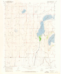
1968 · Swede Lake
USGS Topo · 1:24,000