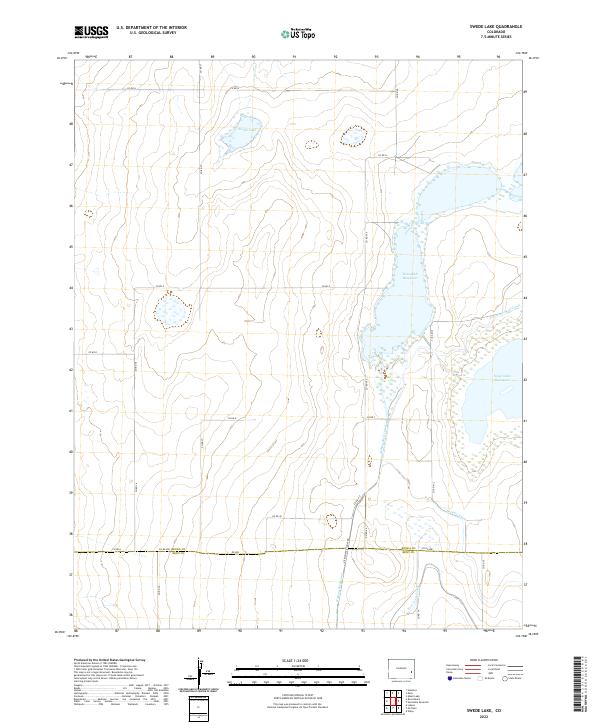
2022 Map of Swede Lake
USGS Topo · Published 2022About this map
Neesopah Reservoir and Neegronda Reservoir dominate this high plains landscape along the southern border of Kiowa County. The region is defined by an extensive system of water management, where the Kicking Bird Canal, Lone Wolf Canal, and Satanta Canal move water across the arid terrain. The boundary between Kiowa County and Bent County is clearly delineated near the southern edge of the sheet, where the prominent Fort Lyon Canal follows the low-lying topography. The map illustrates the grid-based development of the area through an established network of secondary roads, including Co Rd H and Co Rd WW, which serve the scattered water bodies such as Swede Lake. This infrastructure reveals the essential relationship between irrigation and land use in this part of eastern Colorado.
Find a feature on this map
31 named features on this map. Tap any name to fly to it.
Don’t see what you’re looking for? This feature index may not catch every label — zoom into the map to look around manually.
Map Details
Editions of this 2022 Swede Lake Map
This is the sole edition of this map. No revisions or reprints were ever made.
Other maps of this area

1892 · Lamar
USGS Topo · 1:125,000

1954 · Lamar
USGS Topo · 1:250,000

1955 · McClave
USGS Topo · 1:24,000

1955 · Lubers
USGS Topo · 1:24,000

1955 · Wiley
USGS Topo · 1:24,000

1958 · Lamar
USGS Topo · 1:250,000

1967 · Neenoshe Reservoir
USGS Topo · 1:24,000

1968 · Rose Ranch
USGS Topo · 1:24,000
1968 · Alkali Lake
USGS Topo · 1:24,000
1968 · Swede Lake
USGS Topo · 1:24,000