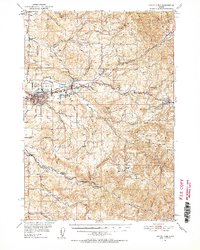
1951 Map of Sweet Home
USGS Topo · Published 1952About this map
South Santiam River serves as the central artery for this timber and river valley landscape, where the town of Sweet Home is established as a regional hub. The Oregon Electric railroad lines trace the valley floor, connecting smaller settlements like Foster and Mitchell to the broader regional economy. The 1951 field survey reveals a community deeply rooted in its local geography, evidenced by the numerous family-scale cemeteries like Berlin Cem and Ames Cem, and rural educational outposts including Sunnyside School and Pleasant Valley Sch.
Find a feature on this map
75 named features on this map. Tap any name to fly to it.
Don’t see what you’re looking for? This feature index may not catch every label — zoom into the map to look around manually.
Map Details
Editions of this 1951 Sweet Home Map
4 editions found

Other maps of this area

1921 · Brownsville
USGS Topo · 1:62,500

1921 · Lebanon
USGS Topo · 1:62,500

1922 · Lebanon
USGS Topo · 1:48,000

1924 · Lebanon
USGS Topo · 1:62,500

1929 · Mill City
USGS Topo · 1:125,000

1934 · Mc Kenzie Bridge
USGS Topo · 1:96,000

1940 · Lebanon
USGS Topo · 1:62,500

1940 · Mc Kenzie Bridge
USGS Topo · 1:125,000

1944 · Lebanon
USGS Topo · 1:62,500

1950 · Marcola
USGS Topo · 1:62,500