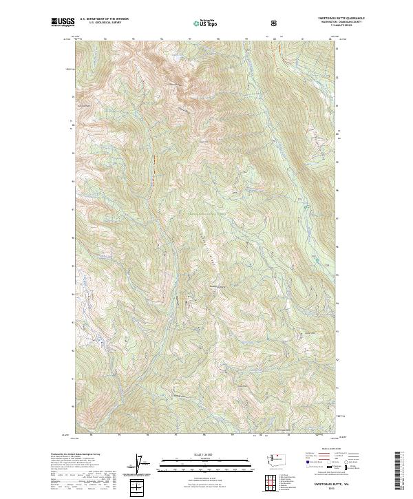
2023 Map of Sweetgrass Butte
USGS Topo · Published 2023About this map
Sweetgrass Butte rises at the center of this high-country landscape within the Okanogan National Forest, where steep ridges and deep drainages define the North Cascades terrain. The northern reaches of the sheet cross into the Pasayten Wilderness, anchored by prominent summits like Sherman Peak and Sunrise Peak. This geography is a network of watersheds where Eightmile Creek, Goat Creek, and Panther Creek have carved out distinct valleys. Historically significant high-altitude routes are marked by Banker Pass, Cub Pass, and Fifth Creek Pass, which once served as vital connecting points across Sweetgrass Ridge and Isabella Ridge. The inclusion of various parcel boundaries like PB 37 and PB 40 indicates the complex administrative history of these public lands, while features like Glance Lake and Island Mtn highlight the diverse topography encountered by early rangers and surveyors.
Find a feature on this map
48 named features on this map. Tap any name to fly to it.
Don’t see what you’re looking for? This feature index may not catch every label — zoom into the map to look around manually.
Map Details
Editions of this 2023 Sweetgrass Butte Map
This is the sole edition of this map. No revisions or reprints were ever made.
Other maps of this area

1955 · Concrete
USGS Topo · 1:250,000

1958 · Concrete
USGS Topo · 1:250,000

1962 · Concrete
USGS Topo · 1:250,000

1962 · Mazama
USGS Topo · 1:62,500

1963 · Doe Mountain
USGS Topo · 1:62,500

1969 · Mt. Barney
USGS Topo · 1:24,000

1969 · Lost Peak
USGS Topo · 1:24,000

1969 · Billy Goat Mtn
USGS Topo · 1:24,000
1991 · Rendevous Mountain
USGS Topo · 1:24,000
1991 · Mazama
USGS Topo · 1:24,000