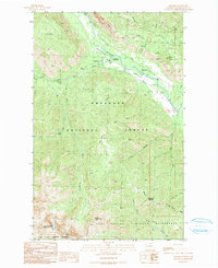
1991 Map of Mazama
USGS Topo · Published 1991About this map
The Methow Valley and the small community of Mazama serve as the focal points of this 1991 survey, which captures the intersection of recreation and resource exploration in northern Washington. The terrain is defined by dramatic elevations, including the vertical face of Goat Wall and the peaks of Flagg Mountain and McKinney Mountain. Within the Okanogan National Forest, the map identifies several Prospect sites and an Adit, indicating localized mining activity in the late 20th century.
Find a feature on this map
34 named features on this map. Tap any name to fly to it.
Don’t see what you’re looking for? This feature index may not catch every label — zoom into the map to look around manually.
Map Details
Editions of this 1991 Mazama Map
This is the sole edition of this map. No revisions or reprints were ever made.
Other maps of this area

1899 · Methow
USGS Topo · 1:125,000

1901 · Methow
USGS Topo · 1:125,000

1902 · Stehekin
USGS Topo · 1:125,000

1904 · Stehekin
USGS Topo · 1:125,000

1920 · Slate Pass
USGS Topo · 1:125,000

1955 · Concrete
USGS Topo · 1:250,000

1958 · Concrete
USGS Topo · 1:250,000

1962 · Concrete
USGS Topo · 1:250,000

1962 · Mazama
USGS Topo · 1:62,500

1963 · Silver Star Mtn.
USGS Topo · 1:24,000