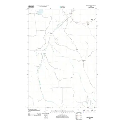
2010 Map of Sweetwater
USGS Topo · Published 2010About this map
Sweetwater and the nearby settlement of Webb anchor this landscape, where the Idaho terrain is defined by a complex network of canyons and ridges. The presence of Sweetwater Cemetery and Red Elk Cemetery offers important touchpoints for genealogical research in this part of Nez Perce County. Water management is central to the area's geography, visible through the Sweetwater Canal and Webb Creek Canal which divert flow toward Mann Lake and the Reservoir A Dam. High ground like McCormack Ridge and Webb Ridge overlooks deep drainage features such as Packers Gulch and Polly Canyon. This 2010 survey details the transition from the creek bottoms of Lapwai Creek to the surrounding grades, including Wild Rose Grade, reflecting the rural infrastructure of the early 21st century.
Find a feature on this map
35 named features on this map. Tap any name to fly to it.
Don’t see what you’re looking for? This feature index may not catch every label — zoom into the map to look around manually.
Map Details
Editions of this 2010 Sweetwater Map
This is the sole edition of this map. No revisions or reprints were ever made.
Other maps of this area

1946 · Limekiln Rapids
USGS Topo · 1:62,500

1955 · Pullman
USGS Topo · 1:250,000

1958 · Pullman
USGS Topo · 1:250,000

1958 · Lapwai
USGS Topo · 1:24,000

1958 · Sweetwater
USGS Topo · 1:24,000

1958 · Lewiston Orchards North
USGS Topo · 1:24,000

1958 · Lewiston Orchards South
USGS Topo · 1:24,000

1958 · Lewiston Orchards
USGS Topo · 1:62,500

1958 · Culdesac
USGS Topo · 1:62,500

1968 · Waha
USGS Topo · 1:24,000