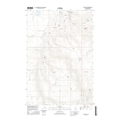
2017 Map of Sweetwater
USGS Topo · Published 2017About this map
Lapwai Valley forms a focal point of this Nez Perce County landscape, where the settlements of Sweetwater and Webb are established along the drainage of Sweetwater Creek and Lapwai Creek. The map documents a complex network of water management, visible in the Sweetwater Canal and the southern Keith Creek Canal, which support the local geography alongside Mann Lake. This 2017 survey details family-named infrastructure and landform markers, such as McCormack Ridge, Thiessen Gulch, and the remote Bundy settlement near the eastern edge. Local history and genealogy are preserved through the locations of the Sweetwater Cemetery and Red Elk Cemetery, while the winding mountain roads like Cemetery Grade and Sander Grade illustrate the steep transitions from the valley floor to the high ridges of Webb Ridge and Packers Gulch.
Find a feature on this map
56 named features on this map. Tap any name to fly to it.
Don’t see what you’re looking for? This feature index may not catch every label — zoom into the map to look around manually.
Map Details
Editions of this 2017 Sweetwater Map
This is the sole edition of this map. No revisions or reprints were ever made.
Other maps of this area

1946 · Limekiln Rapids
USGS Topo · 1:62,500

1955 · Pullman
USGS Topo · 1:250,000

1958 · Pullman
USGS Topo · 1:250,000

1958 · Lapwai
USGS Topo · 1:24,000

1958 · Sweetwater
USGS Topo · 1:24,000

1958 · Lewiston Orchards North
USGS Topo · 1:24,000

1958 · Lewiston Orchards South
USGS Topo · 1:24,000

1958 · Lewiston Orchards
USGS Topo · 1:62,500

1958 · Culdesac
USGS Topo · 1:62,500

1968 · Waha
USGS Topo · 1:24,000