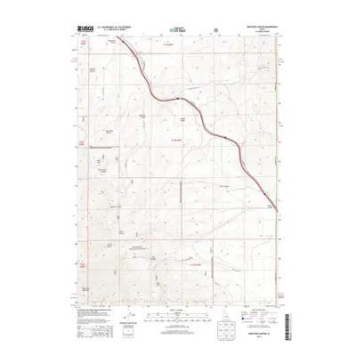
2013 Map of Sweetzer Canyon
USGS Topo · Published 2013About this map
The Sawtooth National Forest dominates the southern half of this landscape in Cassia County, Idaho, where high-desert canyons and drainage networks define the topography. The Black Pine Mountains rise to the southwest, sending numerous drainages such as Jones Canyon and Pole Canyon northeast toward the lower elevations. The map reveals a land structured by water and elevation, from the perennial flow of Meadow Cr in the north to the isolated Mud Spring found within Mud Spring Canyon.
Find a feature on this map
24 named features on this map. Tap any name to fly to it.
Don’t see what you’re looking for? This feature index may not catch every label — zoom into the map to look around manually.
Map Details
Editions of this 2013 Sweetzer Canyon Map
This is the sole edition of this map. No revisions or reprints were ever made.
Other maps of this area

1954 · Pocatello
USGS Topo · 1:250,000

1958 · Pocatello
USGS Topo · 1:250,000

1958 · Sublett
USGS Topo · 1:62,500

1959 · Strevell
USGS Topo · 1:62,500

1973 · Juniper
USGS Topo · 1:24,000

1973 · Sublett Troughs
USGS Topo · 1:24,000

1973 · Black Pine
USGS Topo · 1:24,000
1984 · Malad City
USGS Topo · 1:100,000
1985 · Sandrock Canyon
USGS Topo · 1:24,000
1985 · Strevell
USGS Topo · 1:24,000