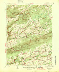
1946 Map of Sybertsville
USGS Topo · Published 1946About this map
Nescopeck Mountain forms a massive central ridge across this portion of Luzerne County, separating the Wapwallopen Creek drainage to the north from the Nescopeck Creek basin to the south. In the years following World War II, the landscape remained deeply rural, defined by a network of small schoolhouses such as Whitebread Sch, Werner Sch, and Walters Sch that served dispersed farming communities. Settlement is concentrated in small clusters at Sybertsville, St Johns, and Drums along the southern edge, while Hobbie sits atop the northern heights. The presence of Hazleton Airport and the path of State Route 29 indicate the early 20th-century modernization of local transport. Local recreation is evident in sites like Boy Scout Camp and Camp Keller, while the ridgeline at Council Cup offers a dramatic vantage point over the winding valley below.
Find a feature on this map
34 named features on this map. Tap any name to fly to it.
Don’t see what you’re looking for? This feature index may not catch every label — zoom into the map to look around manually.
Map Details
Editions of this 1946 Sybertsville Map
2 editions found

Other maps of this area

1889 · Hazleton
USGS Topo · 1:62,500

1891 · Wilkesbarre
USGS Topo · 1:62,500

1891 · Hazleton
USGS Topo · 1:62,500

1892 · Mahanoy
USGS Topo · 1:62,500

1893 · Hazleton
USGS Topo · 1:62,500

1893 · Mahanoy
USGS Topo · 1:62,500

1894 · Shickshinny
USGS Topo · 1:62,500

1894 · Wilkesbarre
USGS Topo · 1:62,500

1943 · Scranton
USGS Topo · 1:125,000

1944 · Newark
USGS Topo · 1:250,000
Featured Places
- Dorrance Township, PA
- Conyngham Township, PA
- Slocum Township, PA
- Nescopeck Township, PA
- Butler Township, PA