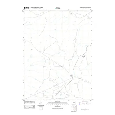
2012 Map of Sybille Springs
USGS Topo · Published 2012About this map
Sybille Springs and the surrounding high-country watersheds of Albany County are defined by a complex network of creeks and prominent landforms. The landscape is marked by substantial elevations like Pine Ridge, Flat Top, and Round Top, which overlook the winding paths of N Sybille Cr and Plumbago Cr. These watercourses have carved significant features such as Plumbago Canyon and Morton Pass, dictating the routes for early transit and later roadways. Settlement is sparse, represented by the Farley Ranch at the southern edge of the quadrangle. Hydrological features including Moore Reservoir, Stumpf Spring, and Gates Cr illustrate the vital importance of water management and natural springs in this semi-arid Wyoming environment during the early 21st century.
Find a feature on this map
17 named features on this map. Tap any name to fly to it.
Don’t see what you’re looking for? This feature index may not catch every label — zoom into the map to look around manually.
Map Details
Editions of this 2012 Sybille Springs Map
This is the sole edition of this map. No revisions or reprints were ever made.
Other maps of this area

1954 · Cheyenne
USGS Topo · 1:250,000

1955 · Bosler
USGS Topo · 1:24,000

1955 · Bosler SE
USGS Topo · 1:24,000

1955 · Mc Gill Lakes
USGS Topo · 1:24,000

1955 · Bluegrass Wells
USGS Topo · 1:24,000

1955 · Sybille Springs
USGS Topo · 1:24,000

1955 · Lake Ione
USGS Topo · 1:24,000

1955 · Guide Rock
USGS Topo · 1:24,000

1955 · Baldy Mountain
USGS Topo · 1:24,000

1955 · Sheep Rock
USGS Topo · 1:24,000