
1955 Map of Bosler
USGS Topo · Published 1956About this map
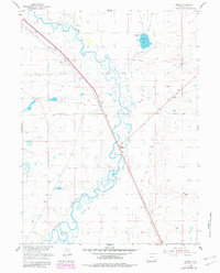
Bosler and its neighbor Bosler Junction serve as the primary human touchpoints in this mid-century high-plains landscape. The Union Pacific railroad and the Lincoln Highway cut a precise diagonal through the territory, highlighting the area's role as a vital transportation corridor through Albany County. The meandering Laramie River contrasts with the rigid geometry of the local irrigation network, which includes the Boughton Canal, Oasis Canal, and an Abandoned Canal. These water-management features, along with the Spoil Bank and several scattered windmills, suggest a landscape defined by the effort to harness surface water for ranching and agriculture. The presence of Diamond Ranch and Diamond Lake further underscores the localized economic focus on land and livestock during this era of development in the Missouri River Basin.
Find a feature on this map
15 named features on this map. Tap any name to fly to it.
Don’t see what you’re looking for? This feature index may not catch every label — zoom into the map to look around manually.
Map Details
Editions of this 1955 Bosler Map
2 editions found
Other maps of this area

1895 · Laramie
USGS Topo · 1:125,000

1902 · Laramie
USGS Topo · 1:125,000

1905 · Laramie
USGS Topo · 1:125,000

1906 · Laramie
USGS Topo · 1:125,000

1908 · Laramie
USGS Topo · 1:125,000

1954 · Cheyenne
USGS Topo · 1:250,000

1955 · Bosler SE
USGS Topo · 1:24,000

1955 · Cooper Lake South
USGS Topo · 1:24,000

1955 · Sybille Springs
USGS Topo · 1:24,000

1955 · Cooper Lake North
USGS Topo · 1:24,000