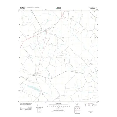
2011 Map of Sycamore
USGS Topo · Published 2011About this map
Salkehatchie River drainage patterns define this South Carolina landscape, where the settlements of Sycamore and Ulmer serve as local anchors. The map reveals a rural economy tied to the land and water, evidenced by Tutens Millpond and the Tutens Mill Pond Dam in the southern reaches. Numerous family and community landmarks are scattered across the terrain, including Mount Calvary Cemetery, Kirkland Cemetery, and Harter Cemetery, which offer valuable points of reference for genealogists and local historians. Transportation is primarily facilitated by a network of state roads like State Hwy S-3-191 and older routes such as Old Orangeburg Rd. The presence of the Ulmers Lookout Tower and Phillips Airstrip highlights the mix of forest management and private aviation infrastructure in the early 21st century. The wetland systems of Miller Swamp and Jackson Branch weave through the lower elevations, illustrating the hydrological character of the region.
Find a feature on this map
68 named features on this map. Tap any name to fly to it.
Don’t see what you’re looking for? This feature index may not catch every label — zoom into the map to look around manually.
Map Details
Editions of this 2011 Sycamore Map
This is the sole edition of this map. No revisions or reprints were ever made.
Other maps of this area

1918 · Varnville
USGS Topo · 1:62,500

1919 · Olar
USGS Topo · 1:62,500

1919 · Allendale
USGS Topo · 1:62,500

1920 · Peeples
USGS Topo · 1:62,500

1943 · Olar
USGS Topo · 1:62,500

1943 · Allendale
USGS Topo · 1:62,500

1943 · Peeples
USGS Topo · 1:62,500

1944 · Varnville
USGS Topo · 1:62,500

1947 · Savannah
USGS Topo · 1:250,000

1948 · Savannah
USGS Topo · 1:250,000