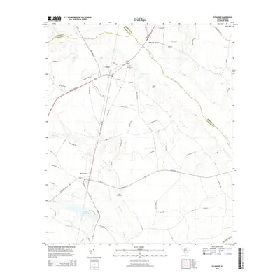
2014 Map of Sycamore
USGS Topo · Published 2014About this map
The Salkehatchie River meanders across this Lowcountry landscape where the borders of Allendale, Bamberg, and Barnwell Counties converge. This area is defined by its deep history of river crossings and small crossroads settlements, notably at Bufords Bridge and Sycamore. The map reveals a rural network of swampy lowlands and family-named landmarks, including Tutens Millpond and several established burial grounds like Miller Creek Cem and Harter Cem. The transport infrastructure follows long-established routes, such as the Confederate Hwy and Burton's Ferry Hwy, which connect the interior to former ferry and bridge sites. Evidence of forestry and fire management appears at the Ulmers Lookout Tower near Ulmer, while numerous waterways like Miller Swamp and Bear Br carve through the coastal plain terrain.
Find a feature on this map
83 named features on this map. Tap any name to fly to it.
Don’t see what you’re looking for? This feature index may not catch every label — zoom into the map to look around manually.
Map Details
Editions of this 2014 Sycamore Map
This is the sole edition of this map. No revisions or reprints were ever made.
Other maps of this area

1918 · Varnville
USGS Topo · 1:62,500

1919 · Olar
USGS Topo · 1:62,500

1919 · Allendale
USGS Topo · 1:62,500

1920 · Peeples
USGS Topo · 1:62,500

1943 · Olar
USGS Topo · 1:62,500

1943 · Allendale
USGS Topo · 1:62,500

1943 · Peeples
USGS Topo · 1:62,500

1944 · Varnville
USGS Topo · 1:62,500

1947 · Savannah
USGS Topo · 1:250,000

1948 · Savannah
USGS Topo · 1:250,000