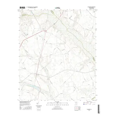
2017 Map of Sycamore
USGS Topo · Published 2017About this map
The Salkehatchie River and its dense network of tributaries, including Kirkland Cr and Miller Swamp, define the low-lying terrain of this Allendale County landscape. At the intersection of rail and road sits Ulmer, while the smaller community of Sycamore serves as a local anchor further south. The map reveals a deeply rooted rural society, evidenced by the numerous burial grounds and places of worship that dot the countryside, such as Miller Swamp Church and Mount Calvary Cem.
Find a feature on this map
67 named features on this map. Tap any name to fly to it.
Don’t see what you’re looking for? This feature index may not catch every label — zoom into the map to look around manually.
Map Details
Editions of this 2017 Sycamore Map
This is the sole edition of this map. No revisions or reprints were ever made.
Other maps of this area

1918 · Varnville
USGS Topo · 1:62,500

1919 · Olar
USGS Topo · 1:62,500

1919 · Allendale
USGS Topo · 1:62,500

1920 · Peeples
USGS Topo · 1:62,500

1943 · Olar
USGS Topo · 1:62,500

1943 · Allendale
USGS Topo · 1:62,500

1943 · Peeples
USGS Topo · 1:62,500

1944 · Varnville
USGS Topo · 1:62,500

1947 · Savannah
USGS Topo · 1:250,000

1948 · Savannah
USGS Topo · 1:250,000