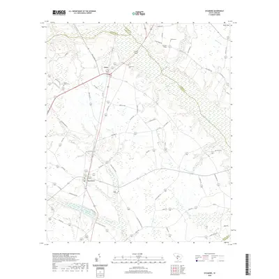
2020 Map of Sycamore
USGS Topo · Published 2020About this map
The Salkehatchie River defines the low-lying geography of this corner of Allendale County, winding through a landscape of wetlands and quiet rural crossroads. Small agrarian settlements such as Sycamore and Ulmer serve as the primary hubs for the surrounding farmsteads, connected by a network of local routes like Old Orangeburg Rd and Williams Rd. The area is notably characterized by its numerous small burial grounds and places of worship, including Miller Swamp Church and Salkehatchie Cem, which anchor the local community history. Water plays a central role in the terrain, with Tutens Millpond and Miller Swamp illustrating the slow-moving drainage typical of the South Carolina Lowcountry. These features, along with names like Gin House Rd and Pond Town Rd, suggest a long-standing reliance on the land and its natural resources for the local economy and social structure.
Find a feature on this map
62 named features on this map. Tap any name to fly to it.
Don’t see what you’re looking for? This feature index may not catch every label — zoom into the map to look around manually.
Map Details
Editions of this 2020 Sycamore Map
This is the sole edition of this map. No revisions or reprints were ever made.
Other maps of this area

1918 · Varnville
USGS Topo · 1:62,500

1919 · Olar
USGS Topo · 1:62,500

1919 · Allendale
USGS Topo · 1:62,500

1920 · Peeples
USGS Topo · 1:62,500

1943 · Olar
USGS Topo · 1:62,500

1943 · Allendale
USGS Topo · 1:62,500

1943 · Peeples
USGS Topo · 1:62,500

1944 · Varnville
USGS Topo · 1:62,500

1947 · Savannah
USGS Topo · 1:250,000

1948 · Savannah
USGS Topo · 1:250,000