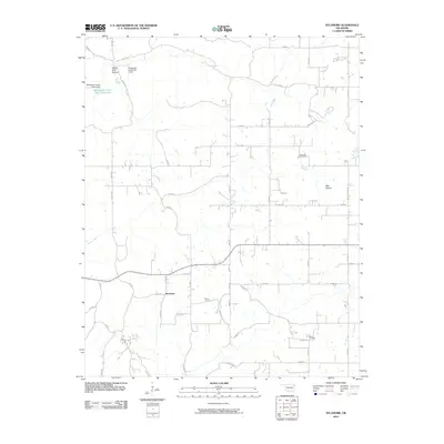
2010 Map of Sycamore
USGS Topo · Published 2010About this map
Sycamore and its surrounding countryside in Delaware County are defined by a grid of rural roads and water management features. The landscape transitions from the open Wet Prairie in the east to the timbered drainage of Yellow Bird Hollow in the northwest. Local history is anchored by the Indianola Cemetery and Ward Cemetery, which serve as primary landmarks for genealogists tracing families in this corner of Oklahoma.
Find a feature on this map
47 named features on this map. Tap any name to fly to it.
Don’t see what you’re looking for? This feature index may not catch every label — zoom into the map to look around manually.
Map Details
Editions of this 2010 Sycamore Map
This is the sole edition of this map. No revisions or reprints were ever made.
Other maps of this area

1899 · Siloam Springs
USGS Topo · 1:125,000

1903 · Siloam Springs
USGS Topo · 1:125,000

1904 · Siloam Springs
USGS Topo · 1:125,000

1907 · Wyandotte
USGS Topo · 1:125,000

1909 · Wyandotte
USGS Topo · 1:125,000

1954 · Tulsa
USGS Topo · 1:250,000

1958 · Tulsa
USGS Topo · 1:250,000

1963 · Tulsa
USGS Topo · 1:250,000

1964 · Dodge
USGS Topo · 1:24,000
1965 · South West City
USGS Topo · 1:24,000