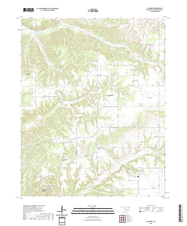
2022 Map of Sycamore
USGS Topo · Published 2022About this map
The dispersed rural communities of northeast Oklahoma are documented here along the winding waters of Beaty Cr and Whitewater Cr. This landscape in Delaware County is defined by its deep creek valleys and named topographic depressions like Yellow Bird Hollow. Small clusters of activity are centered at Sycamore, Indianola, and the combined area of Oak Hill-Piney, while high ground features open areas such as Wet Prairie. Genealogical value is found in the scattered burial grounds that serve these communities, including Indianola Cem, Mount Hermon Cem, and Ward Cem. The area's infrastructure consists primarily of a dense network of numbered county roads, such as Keithly RD and Oak Hill RD, which follow the section lines and natural contours between Deer Lick and the surrounding timbered ridges.
Find a feature on this map
77 named features on this map. Tap any name to fly to it.
Don’t see what you’re looking for? This feature index may not catch every label — zoom into the map to look around manually.
Map Details
Editions of this 2022 Sycamore Map
This is the sole edition of this map. No revisions or reprints were ever made.
Other maps of this area

1899 · Siloam Springs
USGS Topo · 1:125,000

1903 · Siloam Springs
USGS Topo · 1:125,000

1904 · Siloam Springs
USGS Topo · 1:125,000

1907 · Wyandotte
USGS Topo · 1:125,000

1909 · Wyandotte
USGS Topo · 1:125,000

1954 · Tulsa
USGS Topo · 1:250,000

1958 · Tulsa
USGS Topo · 1:250,000

1963 · Tulsa
USGS Topo · 1:250,000

1964 · Dodge
USGS Topo · 1:24,000
1965 · South West City
USGS Topo · 1:24,000