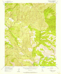
1956 Map of Sycamore Flat
USGS Topo · Published 1958About this map
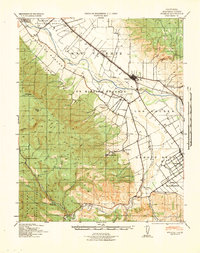
The northern slopes of the Sierra Paloma Ridge define this mid-century landscape within the Los Padres National Forest, where canyon-and-ridge topography dictated a scattered network of remote outposts. Settlement patterns are characterized by family-named holdings and seasonal sites like George Ranch, Hicks Ranch, and Purd Camp. Near the southern edge, the map documents a transition into the drainage of the Arroyo Seco, where the namesake Sycamore Flat and nearby Grandmas Flat provide rare level ground. Resource extraction and recreation are noted through several features, including an Oil Test Well and the Rio Alto Gun Club (Aband). Water management is critical in this dry terrain, evidenced by several strategically placed Water Tanks and the presence of The Dry Lake and Piney Creek. Navigation through the canyon system relies on the Jamesburg Road and a series of rugged Jeep Trails connecting the various ranch properties.
Find a feature on this map
34 named features on this map. Tap any name to fly to it.
Don’t see what you’re looking for? This feature index may not catch every label — zoom into the map to look around manually.
Map Details
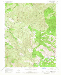
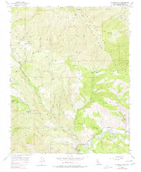
Editions of this 1956 Sycamore Flat Map
4 editions found

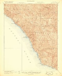
Other maps of this area

1910 · Soledad
USGS Topo · 1:31,680

1915 · Soledad
USGS Topo · 1:62,500

1919 · Junipero Serra
USGS Topo · 1:62,500

1920 · Jamesburg
USGS Topo · 1:48,000

1921 · Jamesburg
USGS Topo · 1:62,500
1921 · Lucia
USGS Topo · 1:62,500

1939 · Jamesburg
USGS Topo · 1:62,500

1940 · Jamesburg
USGS Topo · 1:62,500
1940 · Soledad
USGS Topo · 1:62,500

1941 · Lucia
USGS Topo · 1:62,500