2023 Map of Sylvan Beach
USGS Topo · Published 2023About this map
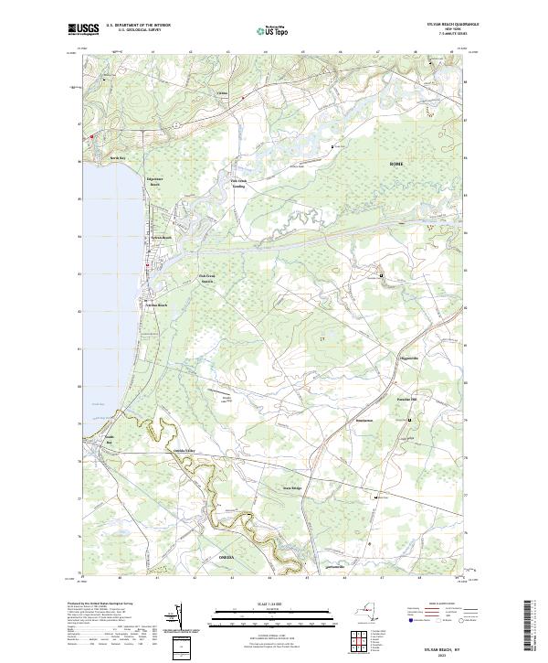
Sylvan Beach and Verona Beach anchor the eastern shoreline of Oneida Lake, where the historic passage of the Erie Canal intersects the natural drainage of Fish Creek. This modern survey documents a landscape defined by the convergence of legacy waterways and recreational lakefront, stretching from the northern settlement of Vienna down toward Durhamville in the south. The map provides a clear record of the boundary between Oneida Co and Madison Co as it follows the winding course of Oneida Creek. Inland from the beaches, small hamlets like Higginsville, Dumbarton, and State Bridge dot the countryside alongside family-named landmarks such as Paradise Hill and Irish Ridge. Genealogists will find several burial sites preserved across the township, including Murray Cem, Cook Cem, and Doxtater Cem, while those studying the canal's path can trace its parallel journey with Wood Creek through the wetlands east of Fish Creek Station.
Find a feature on this map
103 named features on this map. Tap any name to fly to it.
Don’t see what you’re looking for? This feature index may not catch every label — zoom into the map to look around manually.
Map Details
Editions of this 2023 Sylvan Beach Map
This is the sole edition of this map. No revisions or reprints were ever made.
Historical Maps of Durhamville Through Time
3 maps found