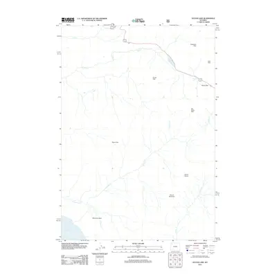
2012 Map of Sylvan Lake
USGS Topo · Published 2012About this map
Sylvan Pass serves as a critical high-altitude corridor in this 2012 survey, where the roadway winds between Avalanche Peak and Hoyt Peak before descending toward the eastern edge of Yellowstone Lake. The landscape is defined by its dramatic vertical relief and complex drainage network, including the headwaters of Columbine Cr and Clear Cr. High peaks such as Grizzly Peak and Top Notch Peak dominate the skyline, while the southern portion of the map transitions into the Signal Hills and the geological curiosity of Brimstone Basin. This map captures the intricate relationship between the region's prominent summits, such as Mount Stevenson and Mount Doane, and the various glacial lakes, including the namesake Sylvan Lake and nearby Eleanor Lake. The layout of the modern highway through the pass illustrates the persistent path of travel dictated by these mountain gaps.
Find a feature on this map
18 named features on this map. Tap any name to fly to it.
Don’t see what you’re looking for? This feature index may not catch every label — zoom into the map to look around manually.
Map Details
Editions of this 2012 Sylvan Lake Map
This is the sole edition of this map. No revisions or reprints were ever made.
Other maps of this area

1885 · Lake
USGS Topo · 1:125,000

1886 · Canyon
USGS Topo · 1:125,000

1895 · Canyon
USGS Topo · 1:125,000

1895 · Lake
USGS Topo · 1:125,000

1896 · Lake
USGS Topo · 1:125,000

1896 · Canyon
USGS Topo · 1:125,000

1901 · Canyon
USGS Topo · 1:125,000

1901 · Lake
USGS Topo · 1:125,000

1906 · Lake
USGS Topo · 1:125,000

1907 · Canyon
USGS Topo · 1:125,000