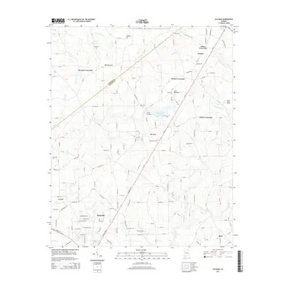
2014 Map of Sylvania
USGS Topo · Published 2014About this map
Sand Mountain defines the topography of this DeKalb County landscape, where plateaus and drainage systems like S Sauty Cr and Town Creek shape the distribution of northern Alabama settlements. The area is characterized by numerous crossroad communities, including Bowman Crossroads, Brooks Crossroads, and Mahan Crossroads, reflecting a historical pattern of development centered around rural transportation hubs. Sylvania and the northern reaches of Rainsville serve as primary population centers, connected by the diagonal corridor of Al-75. Genealogists will find significant value in the documentation of local burial sites such as Dean Chapel Cem, Samples Cem, and New Bethel Cem. The map also captures specialized land use, from the DeKalb County Public Lake to the Sweet Home Airport in the east, illustrating how the land has been adapted for recreation and local aviation alongside its traditional agricultural and residential foundations.
Find a feature on this map
42 named features on this map. Tap any name to fly to it.
Don’t see what you’re looking for? This feature index may not catch every label — zoom into the map to look around manually.
Map Details
Editions of this 2014 Sylvania Map
This is the sole edition of this map. No revisions or reprints were ever made.
Other maps of this area

1886 · Stevenson
USGS Topo · 1:125,000

1892 · Stevenson
USGS Topo · 1:125,000

1893 · Fort Payne
USGS Topo · 1:125,000

1895 · Stevenson
USGS Topo · 1:125,000

1898 · Fort Payne
USGS Topo · 1:125,000

1900 · Fort Payne
USGS Topo · 1:125,000

1936 · Ider
USGS Topo · 1:24,000

1936 · Dugout Valley
USGS Topo · 1:24,000

1936 · Chavies
USGS Topo · 1:24,000

1936 · Dutton
USGS Topo · 1:24,000