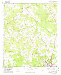
1978 Map of Sylvania North
USGS Topo · Published 1978About this map
The rural agricultural landscape of Screven County is anchored here by the community of Hilltonia, where the terrain is defined by the branching networks of Ogeechee Creek and Beaverdam Creek. In the late 1970s, the area retained a high density of country churches and family-named cemeteries, which serve as critical markers for local genealogy. Notable landmarks include Little Bethel Ch near Bascom, while the southern reaches of the map show the edge of Sylvania and local recreational spots like the Brier Creek Country Club and a Drive-in Theater. The map captures a transitional era of rural infrastructure, with small crossroads such as Lewis and Substa connected by a web of light-duty and unimproved roads. Prominent family names are preserved through landmarks like Lariscy Grove Ch and Waters Grove Cem, offering a detailed view of the county's social geography before late-century modernization.
Find a feature on this map
40 named features on this map. Tap any name to fly to it.
Don’t see what you’re looking for? This feature index may not catch every label — zoom into the map to look around manually.
Map Details
Editions of this 1978 Sylvania North Map
This is the sole edition of this map. No revisions or reprints were ever made.
Other maps of this area

1918 · Oliver
USGS Topo · 1:62,500

1920 · Hilltonia
USGS Topo · 1:62,500

1920 · Millen
USGS Topo · 1:62,500

1920 · Oliver
USGS Topo · 1:62,500

1921 · Rocky Ford
USGS Topo · 1:62,500

1943 · Hilltonia
USGS Topo · 1:62,500

1943 · Rocky Ford
USGS Topo · 1:62,500

1943 · Millen
USGS Topo · 1:62,500

1943 · Millen
USGS Topo · 1:125,000

1943 · Oliver
USGS Topo · 1:62,500