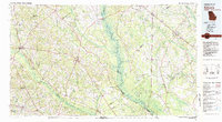
1981 Map of Sylvania
USGS Topo · Published 1982About this map
The Savannah River serves as the central artery for this 1981 survey, defining the border between Georgia and South Carolina. This region is characterized by extensive wetlands and swamps, such as Black Swamp and Whippy Swamp, which contrast with the organized settlement patterns around Sylvania and Millen. To the west, Magnolia Springs State Park marks a significant natural landmark near the Ogeechee River headwaters.
Find a feature on this map
65 named features on this map. Tap any name to fly to it.
Don’t see what you’re looking for? This feature index may not catch every label — zoom into the map to look around manually.
Map Details
Editions of this 1981 Sylvania Map
This is the sole edition of this map. No revisions or reprints were ever made.
Other maps of this area

1918 · Varnville
USGS Topo · 1:62,500

1918 · Yemassee
USGS Topo · 1:62,500

1918 · Oliver
USGS Topo · 1:62,500

1919 · Gough
USGS Topo · 1:62,500

1919 · Pineland
USGS Topo · 1:62,500

1919 · Olar
USGS Topo · 1:62,500

1919 · Shirley
USGS Topo · 1:62,500

1919 · Allendale
USGS Topo · 1:62,500

1919 · Cummings
USGS Topo · 1:62,500

1919 · Egypt
USGS Topo · 1:62,500