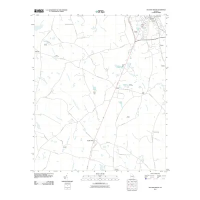
2011 Map of Sylvania South
USGS Topo · Published 2011About this map
The southern outskirts of Sylvania and the rural agricultural lands of Screven County define this landscape as it appeared in the early 21st century. The map centers on the transition from the concentrated street grid of the county seat to the smaller, historical crossroads of Goloid and Double Heads. The territory is intricately laced with water bodies and irrigation infrastructure, including several named earthen dams such as the Miller Pond Dam and Nelson Pond Dam along the Ogeechee Creek drainage system.
Find a feature on this map
66 named features on this map. Tap any name to fly to it.
Don’t see what you’re looking for? This feature index may not catch every label — zoom into the map to look around manually.
Map Details
Editions of this 2011 Sylvania South Map
This is the sole edition of this map. No revisions or reprints were ever made.
Other maps of this area

1918 · Oliver
USGS Topo · 1:62,500

1920 · Hilltonia
USGS Topo · 1:62,500

1920 · Millen
USGS Topo · 1:62,500

1920 · Oliver
USGS Topo · 1:62,500

1921 · Rocky Ford
USGS Topo · 1:62,500

1943 · Hilltonia
USGS Topo · 1:62,500

1943 · Rocky Ford
USGS Topo · 1:62,500

1943 · Millen
USGS Topo · 1:62,500

1943 · Millen
USGS Topo · 1:125,000

1943 · Oliver
USGS Topo · 1:62,500