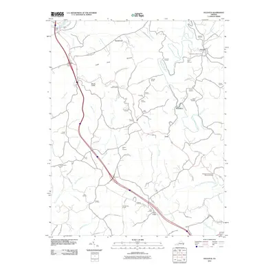
2010 Map of Sylvatus
USGS Topo · Published 2010About this map
Sylvatus and the surrounding Carroll County countryside are defined by a dense network of family-named cemeteries and rural intersections in this 2010 survey. The landscape is carved by the Little Reed Island Creek and its many tributaries, including Moccasin Branch and Ogle Branch, which dictate the winding paths of roads like Lonesome Dove Ln and Round Knob Rd. A significant concentration of burial sites, such as the Quesenberry-Dalton Cemetery, Lilburn Richardson Cemetery, and Jackson Peak Cemetery, provides essential data for genealogists tracing local lineage.
Find a feature on this map
70 named features on this map. Tap any name to fly to it.
Don’t see what you’re looking for? This feature index may not catch every label — zoom into the map to look around manually.
Map Details
Editions of this 2010 Sylvatus Map
This is the sole edition of this map. No revisions or reprints were ever made.
Other maps of this area

1889 · Hillsville
USGS Topo · 1:125,000

1892 · Hillsville
USGS Topo · 1:125,000

1896 · Hillsville
USGS Topo · 1:125,000

1930 · Max Meadows
USGS Topo · 1:62,500

1931 · Galax
USGS Topo · 1:48,000

1933 · Galax
USGS Topo · 1:62,500

1953 · Winston-Salem
USGS Topo · 1:250,000

1955 · Winston-Salem
USGS Topo · 1:250,000

1956 · Macks Mountain
USGS Topo · 1:62,500

1957 · Mount Airy
USGS Topo · 1:62,500