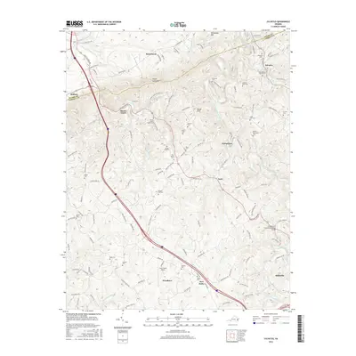
2016 Map of Sylvatus
USGS Topo · Published 2016About this map
Periwinkle Mtn and Poplar Camp Mtn dominate the northern landscape of this region where Wythe and Carroll counties meet. The 2016 terrain is defined by a dense network of family-named cemeteries and small settlements connected by winding mountain roads. From Sylvatus in the northeast to the northern outskirts of Hillsville in the southeast, the map reveals a deeply rooted rural community. The drainage patterns of Little Reed Island Creek and its many tributaries, such as Trout Br and Alum Rock Br, dictate the placement of early homesteads and modern infrastructure like the Twin County Airport. Genealogists will find significant value in the sheer number of documented burial sites, including the Osbourne Cem, Jackson Peak Cem, and Mitchell Cem, which are scattered throughout the hills near crossroads like Five Forks and Woodlawn.
Find a feature on this map
123 named features on this map. Tap any name to fly to it.
Don’t see what you’re looking for? This feature index may not catch every label — zoom into the map to look around manually.
Map Details
Editions of this 2016 Sylvatus Map
This is the sole edition of this map. No revisions or reprints were ever made.
Other maps of this area

1889 · Hillsville
USGS Topo · 1:125,000

1892 · Hillsville
USGS Topo · 1:125,000

1896 · Hillsville
USGS Topo · 1:125,000

1930 · Max Meadows
USGS Topo · 1:62,500

1931 · Galax
USGS Topo · 1:48,000

1933 · Galax
USGS Topo · 1:62,500

1953 · Winston-Salem
USGS Topo · 1:250,000

1955 · Winston-Salem
USGS Topo · 1:250,000

1956 · Macks Mountain
USGS Topo · 1:62,500

1957 · Mount Airy
USGS Topo · 1:62,500