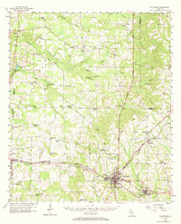
1956 Map of Sylvester
USGS Topo · Published 1969About this map
The railroad junction at Sylvester serves as the focal point of this mid-century survey, where the Atlantic Coast Line Railroad crosses the Georgia and Florida Railroad. This rail intersection anchored a regional economy tied to timber and agriculture, connecting outlying settlements like Poulan, Shingler, and Acree. The landscape is defined by the winding course of Warrior Creek and Abrams Creek, alongside numerous small community centers such as Doles and Terrell.
Find a feature on this map
67 named features on this map. Tap any name to fly to it.
Don’t see what you’re looking for? This feature index may not catch every label — zoom into the map to look around manually.
Map Details
Editions of this 1956 Sylvester Map
2 editions found
Other maps of this area

1953 · Dothan
USGS Topo · 1:250,000

1953 · Waycross
USGS Topo · 1:250,000

1954 · Dothan
USGS Topo · 1:250,000

1955 · Dothan
USGS Topo · 1:250,000

1956 · Albany East
USGS Topo · 1:24,000

1956 · Baconton
USGS Topo · 1:62,500

1956 · Sylvester
USGS Topo · 1:62,500

1956 · Doerun
USGS Topo · 1:62,500

1956 · Albany
USGS Topo · 1:62,500

1956 · Leslie
USGS Topo · 1:62,500