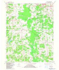
1982 Map of Symsonia
USGS Topo · Published 1983About this map
Symsonia and the surrounding farm country of Graves Co and McCracken Co are defined by the meandering West Fork Clarks River. This landscape, documented in the early 1980s, reveals a network of small agricultural settlements like Hardmoney and Freemont linked by a system of rural roads and creek crossings. The prominence of family and community spaces is evident in the numerous burial grounds and congregations, including Boaz Cem, McClure Cem, and the uniquely named Doom Chapel. Recreation and transportation are marked by the Paducah-International Raceway and the Farrington Airpark, contrasting with older landmarks like the Carters Mill Bridge on Hodge Creek. The map captures a moment when traditional land use patterns, centered on small schools and rural churches like Spring Creek Ch, remained the backbone of the region.
Find a feature on this map
62 named features on this map. Tap any name to fly to it.
Don’t see what you’re looking for? This feature index may not catch every label — zoom into the map to look around manually.
Map Details
Editions of this 1982 Symsonia Map
This is the sole edition of this map. No revisions or reprints were ever made.
Other maps of this area

1926 · Paducah
USGS Topo · 1:62,500

1929 · Smithland
USGS Topo · 1:62,500

1929 · Paducah
USGS Topo · 1:62,500

1936 · Melber
USGS Topo · 1:24,000

1936 · Paducah
USGS Topo · 1:24,000

1936 · Oak Level
USGS Topo · 1:24,000

1936 · Elva
USGS Topo · 1:24,000

1936 · Smithland
USGS Topo · 1:48,000

1936 · Symsonia
USGS Topo · 1:24,000

1936 · Benton
USGS Topo · 1:48,000