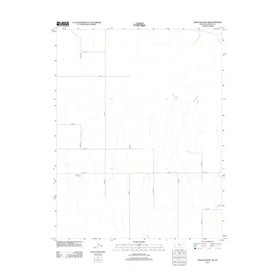
2012 Map of Syracuse West NW
USGS Topo · Published 2012About this map
Sunnyvale Cem stands as a primary landmark in this western Kansas landscape, which is defined by the rigid geometry of the Public Land Survey System. Located in the northern reaches of Hamilton County, the terrain is structured by a network of county roads including Co Road D, Co Road E, and Co Road F. These thoroughfares serve the agricultural sections of the High Plains, where drainage patterns are subtly indicated by seasonal creek beds that interrupt the flat horizon. The transition between township sections is marked by boundary indicators like KH KG, reflecting the administrative precision of the early twenty-first century. This map captures the intersection of rural solitude and human organization, where a single cemetery remains a significant point of reference for local families and genealogists tracing their roots in the Hamilton County soil.
Find a feature on this map
14 named features on this map. Tap any name to fly to it.
Don’t see what you’re looking for? This feature index may not catch every label — zoom into the map to look around manually.
Map Details
Editions of this 2012 Syracuse West NW Map
This is the sole edition of this map. No revisions or reprints were ever made.
Other maps of this area

1890 · Granada
USGS Topo · 1:125,000

1891 · Albany
USGS Topo · 1:125,000

1892 · Granada
USGS Topo · 1:125,000

1893 · Albany
USGS Topo · 1:125,000

1894 · Granada
USGS Topo · 1:125,000

1900 · Syracuse
USGS Topo · 1:125,000

1920 · Syracuse
USGS Topo · 1:125,000

1953 · Holly East
USGS Topo · 1:24,000

1954 · Lamar
USGS Topo · 1:250,000

1955 · La Junta
USGS Topo · 1:250,000