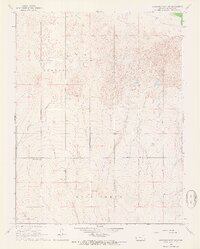
1966 Map of Syracuse West NW
USGS Topo · Published 1967About this map
Coolidge and Medway townships define this corner of Hamilton County, where the High Plains landscape is marked by unique geomorphology. Large swaths of Shifting Sand dominate the northern terrain, indicating an active dune environment north of the Arkansas River valley. The map documents the mid-century infrastructure of the region, including a Pipeline corridor and local industry represented by an Oil Well and a Gravel Pit. Genealogists may find interest in the Sunnyvale Cem, located in the western portion of the sheet. Further south, the topography transitions toward the Bear Creek drainage, showing the characteristic draws and sections that define the rural Kansas grid. A lone Radio Tower stands as a prominent man-made landmark in this otherwise open prairie landscape.
Find a feature on this map
10 named features on this map. Tap any name to fly to it.
Don’t see what you’re looking for? This feature index may not catch every label — zoom into the map to look around manually.
Map Details
Editions of this 1966 Syracuse West NW Map
This is the sole edition of this map. No revisions or reprints were ever made.
Other maps of this area

1890 · Granada
USGS Topo · 1:125,000

1891 · Albany
USGS Topo · 1:125,000

1892 · Granada
USGS Topo · 1:125,000

1893 · Albany
USGS Topo · 1:125,000

1894 · Granada
USGS Topo · 1:125,000

1900 · Syracuse
USGS Topo · 1:125,000

1920 · Syracuse
USGS Topo · 1:125,000

1953 · Holly East
USGS Topo · 1:24,000

1954 · Lamar
USGS Topo · 1:250,000

1955 · La Junta
USGS Topo · 1:250,000