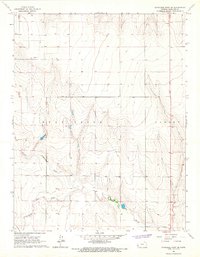
1966 Map of Syracuse West SE
USGS Topo · Published 1967About this map
Bear Creek carves a wandering path across this Hamilton County landscape, joined by its tributaries North Bear Creek and Little Bear Creek. In the mid-1960s, this area of western Kansas remained defined by its drainage systems and the subtle industrial presence of resource extraction. Scattered evidence of local industry appears in the form of a Sandpit, a Gravel Pit, and a lone Oil Well in the northwest corner, reflecting the steady pursuit of geological wealth from the High Plains soil. The map also delineates the Lamont area, where the flat upland terrain begins to break into more complex draws and valleys. The absence of major settlements highlights a period when the land was primarily partitioned by section lines and fence lines, serving as a quiet corner of the state where topography and water rights dictated the pattern of human activity.
Find a feature on this map
11 named features on this map. Tap any name to fly to it.
Don’t see what you’re looking for? This feature index may not catch every label — zoom into the map to look around manually.
Map Details
Editions of this 1966 Syracuse West SE Map
This is the sole edition of this map. No revisions or reprints were ever made.
Other maps of this area

1900 · Syracuse
USGS Topo · 1:125,000

1920 · Syracuse
USGS Topo · 1:125,000

1955 · Dodge City
USGS Topo · 1:250,000

1958 · Dodge City
USGS Topo · 1:250,000

1959 · Dodge City
USGS Topo · 1:250,000

1959 · Big Bow NW
USGS Topo · 1:24,000

1966 · Syracuse West SW
USGS Topo · 1:24,000

1966 · Syracuse East SW
USGS Topo · 1:24,000

1966 · Syracuse East
USGS Topo · 1:24,000
1966 · Syracuse West
USGS Topo · 1:24,000