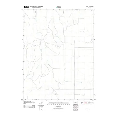
2010 Map of T Draw
USGS Topo · Published 2010About this map
Arikaree River and Middlemist Creek define the drainage patterns of this high plains landscape in Elbert County. This 2010 topographic representation shows a predominantly rural and agricultural layout where the terrain is marked by the namesake T Draw, a landform that influences the local hydrology. The area is structured by a grid of rural routes, including the appropriately named Middle Mist Rd and various numbered corridors such as County Rd-3R and County Rd-21. The sparse distribution of labels reflects a quiet, open region of Colorado where the primary human footprint is found in the network of county roads that crisscross the river valleys and draws.
Find a feature on this map
12 named features on this map. Tap any name to fly to it.
Don’t see what you’re looking for? This feature index may not catch every label — zoom into the map to look around manually.
Map Details
Editions of this 2010 T Draw Map
This is the sole edition of this map. No revisions or reprints were ever made.
Other maps of this area

1891 · Limon
USGS Topo · 1:125,000

1892 · Limon
USGS Topo · 1:125,000

1954 · Limon
USGS Topo · 1:250,000

1957 · Limon
USGS Topo · 1:250,000

1958 · Limon
USGS Topo · 1:250,000

1970 · Limon
USGS Topo · 1:24,000
1970 · Barking Dog Spring
USGS Topo · 1:24,000

1970 · T Draw
USGS Topo · 1:24,000
1970 · River Bend
USGS Topo · 1:24,000

1973 · Last Chance SW
USGS Topo · 1:24,000