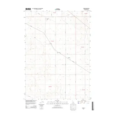
2013 Map of Taber
USGS Topo · Published 2013About this map
The settlement of Taber serves as a central point in this Bingham County landscape, situated along the diagonal path of W Taber Rd. This 2013 survey illustrates a rural Idaho environment defined by a rigid grid of section lines and gravel roads, including McTucker Rd and Well No 2 Rd. The topography is marked by subtle volcanic and industrial features, most notably a Cinder Pit in the northern reaches. To the southeast, the locality of Fullmer sits along the same primary roadway, representing the sparse residential and agricultural development typical of the region. The map provides a clear view of the Public Land Survey System divisions, from t1n r32e down to t2s r33e, reflecting the orderly distribution of land in the high desert.
Find a feature on this map
28 named features on this map. Tap any name to fly to it.
Don’t see what you’re looking for? This feature index may not catch every label — zoom into the map to look around manually.
Map Details
Editions of this 2013 Taber Map
This is the sole edition of this map. No revisions or reprints were ever made.
Other maps of this area

1955 · Springfield NW
USGS Topo · 1:24,000

1955 · Rockford
USGS Topo · 1:24,000

1955 · Idaho Falls
USGS Topo · 1:250,000

1958 · Idaho Falls
USGS Topo · 1:250,000

1973 · Olsen
USGS Topo · 1:24,000

1973 · Middle Butte
USGS Topo · 1:24,000

1973 · Taber
USGS Topo · 1:24,000

1973 · Atomic City
USGS Topo · 1:24,000

1973 · Lava Lake Reservoir
USGS Topo · 1:24,000

1973 · Coffee Point NE
USGS Topo · 1:24,000