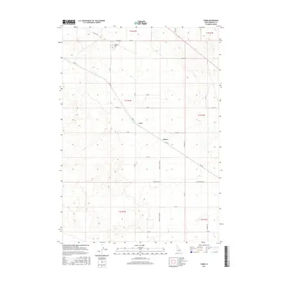
2017 Map of Taber
USGS Topo · Published 2017About this map
Taber and Fullmer anchor this high desert landscape in Bingham County, where the topography is defined by subtle undulations and the organized grid of the Public Land Survey System. The area is dominated by agricultural development and infrastructure, visible in the extensive network of roads like Frontier Farms Rd and Township Rd that partition the sagebrush and lava fields into manageable sections. An industrial presence is marked by the Cinder Pit near the northern boundary, reflecting the volcanic geology of the region. The map captures a moment of modern land management where long, straight thoroughfares such as Taber Rd and Springfield Taber Rd connect these outlying settlements, illustrating the sparse but deliberate human footprint in southeastern Idaho.
Find a feature on this map
31 named features on this map. Tap any name to fly to it.
Don’t see what you’re looking for? This feature index may not catch every label — zoom into the map to look around manually.
Map Details
Editions of this 2017 Taber Map
This is the sole edition of this map. No revisions or reprints were ever made.
Other maps of this area

1955 · Springfield NW
USGS Topo · 1:24,000

1955 · Rockford
USGS Topo · 1:24,000

1955 · Idaho Falls
USGS Topo · 1:250,000

1958 · Idaho Falls
USGS Topo · 1:250,000

1973 · Olsen
USGS Topo · 1:24,000

1973 · Middle Butte
USGS Topo · 1:24,000

1973 · Taber
USGS Topo · 1:24,000

1973 · Atomic City
USGS Topo · 1:24,000

1973 · Lava Lake Reservoir
USGS Topo · 1:24,000

1973 · Coffee Point NE
USGS Topo · 1:24,000