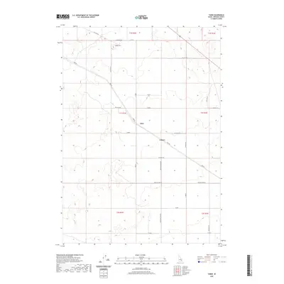
2020 Map of Taber
USGS Topo · Published 2020About this map
Taber and Fullmer anchor this high-desert landscape in Bingham County, where the agricultural grid meets the volcanic geology of the Snake River Plain. The map illustrates a transition from the structured irrigation and homestead developments marked by the Public Land Survey System—including townships like t1s r33e—to the open rangeland further north. A prominent Cinder Pit in the northern section highlights the area's igneous history, while the road network shows the evolution of local transport. The diagonal path of Taber Rd cuts across the cardinal grid of farm roads such as Frontier Farms Rd and Springfield Taber Rd, tracing an older route through the sagebrush and lava fields. This survey captures a specific moment in the modern western landscape where industrial extraction and organized farming define the human footprint.
Find a feature on this map
30 named features on this map. Tap any name to fly to it.
Don’t see what you’re looking for? This feature index may not catch every label — zoom into the map to look around manually.
Map Details
Editions of this 2020 Taber Map
This is the sole edition of this map. No revisions or reprints were ever made.
Other maps of this area

1955 · Springfield NW
USGS Topo · 1:24,000

1955 · Rockford
USGS Topo · 1:24,000

1955 · Idaho Falls
USGS Topo · 1:250,000

1958 · Idaho Falls
USGS Topo · 1:250,000

1973 · Olsen
USGS Topo · 1:24,000

1973 · Middle Butte
USGS Topo · 1:24,000

1973 · Taber
USGS Topo · 1:24,000

1973 · Atomic City
USGS Topo · 1:24,000

1973 · Lava Lake Reservoir
USGS Topo · 1:24,000

1973 · Coffee Point NE
USGS Topo · 1:24,000