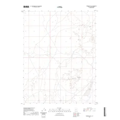
2023 Map of Tabernacle Hill
USGS Topo · Published 2023About this map
Tabernacle Crater and the prominent Tabernacle Hill dominate this portion of the Pahvant Valley, located in central Utah. The volcanic character of the landscape is immediate, defined by the extensive lava fields of The Cinders that spread across the northeastern sections. This 2023 edition reflects a land shaped more by geologic forces than human development, where the sparse presence of water at Squidike Spring is a critical point on the landscape. To the west, the topographic rise of Beaver Ridge borders the alluvial reaches of Clay Flat, illustrating the sharp transition from basaltic flows to dry basin floors. The map provides researchers with a clear record of these distinct landforms and the limited access routes that navigate this arid terrain.
Find a feature on this map
7 named features on this map. Tap any name to fly to it.
Don’t see what you’re looking for? This feature index may not catch every label — zoom into the map to look around manually.
Map Details
Editions of this 2023 Tabernacle Hill Map
This is the sole edition of this map. No revisions or reprints were ever made.
Other maps of this area

1885 · Beaver
USGS Topo · 1:250,000

1885 · Sevier Desert
USGS Topo · 1:250,000

1953 · Richfield
USGS Topo · 1:250,000

1953 · Delta
USGS Topo · 1:250,000

1958 · Richfield
USGS Topo · 1:250,000

1958 · Delta
USGS Topo · 1:250,000

1960 · Meadow
USGS Topo · 1:24,000

1962 · Delta
USGS Topo · 1:250,000

1962 · Fillmore
USGS Topo · 1:62,500
1962 · The Sink
USGS Topo · 1:24,000