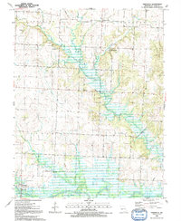
1991 Map of Taberville
USGS Topo · Published 1992About this map
The Osage River flows across the southern reaches of this landscape in St. Clair County, marking a transition from the agricultural uplands to the river bottomlands. Small rural centers like Johnson City and Iuka Springs anchor the northern and central portions of the map, while Taberville sits near the river’s edge with its dedicated Taberville Public Access and Boat Ramp. The map reveals a high density of local cemeteries, including Taber Cem, Ridgeway Cem, and Schoonover Cem, which offer significant value for genealogical research.
Find a feature on this map
33 named features on this map. Tap any name to fly to it.
Don’t see what you’re looking for? This feature index may not catch every label — zoom into the map to look around manually.
Map Details
Editions of this 1991 Taberville Map
This is the sole edition of this map. No revisions or reprints were ever made.
Other maps of this area

1886 · Nevada
USGS Topo · 1:125,000

1886 · Stockton
USGS Topo · 1:125,000

1887 · Clinton
USGS Topo · 1:125,000

1887 · Butler
USGS Topo · 1:125,000

1894 · Butler
USGS Topo · 1:125,000

1894 · Nevada
USGS Topo · 1:125,000

1894 · Clinton
USGS Topo · 1:125,000

1934 · Rockville
USGS Topo · 1:24,000

1937 · Tiffin
USGS Topo · 1:31,680

1938 · Monegaw Springs
USGS Topo · 1:24,000